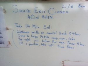
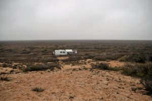
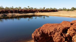
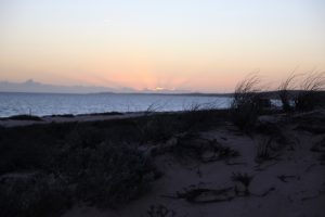
After leaving the West MacDonnells we spent a couple of days back in Alice and then headed south again, overnight at Marla. Marla is a roadhouse come motel come caravan park, nice facilities although a bit worn by the impact of bore water. Next morning we pushed on and had coffee in Cooper Pedy before heading out to the William Creek Hotel. At the William Creek Hotel was a tourist bus that appeared not have been troubled by the track. The road just south of William Creek is badly corrugated but otherwise it is in good shape. That night we camped at Coward Springs.
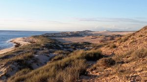
Coward Springs is very isolated not far from Lake Eyre. The owners have created facilities utilising much of the items left from the railway that once ran through this area. For example the door handles are made from insulators once used on the telegraph line. Some of the few railway buildings are being authentically restored. The firewood provided at a small cost was welcome as the evenings are getting chilly this far south. The springs at the campground are accessed through a small pool surrounding by duck boards. This is a great choice for an overnight, or 2, stop.
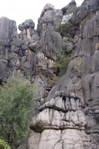
Down the track a couple of km’s is a turnoff to the mounded springs which are mounds about 10m high with a gentle climb to the top where you are surprised to find a pond of hot water disturbed at regular intervals by bubbles of gas emerging. These really are worth a visit.
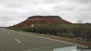
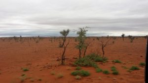
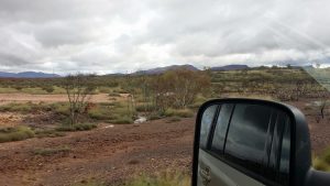
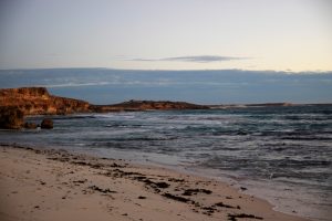
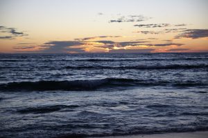
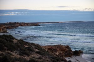
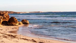
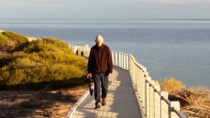
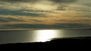
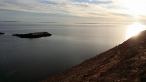
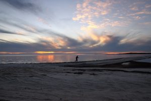
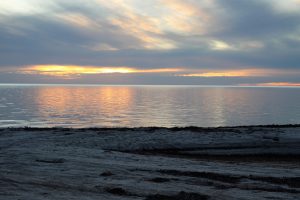
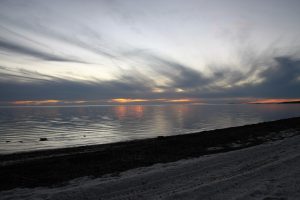
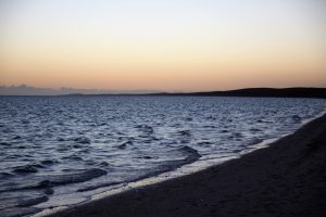
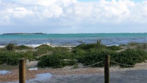
Continuing on toward Maree we stopped for lunch at a lookout at the southern end of Lake Eyre hence the panoramic shot at the top of this blog. What a vast area. From here to Maree we were constantly passing the Variety Bash convoy of unusual vehicles on their way north.
Camped last night at the old schoolhouse campground at Parachilna. But had a very strong feeling it was time to be home.
Over 2 days we used Ormiston as a base and explored the West MacDonnells which has many gorges.
Had lunch at Glen Helen and met with a lady who teaches out on an indigenous community about half a days drive west of Alice Springs. Sounded like a challenging but rewarding venture.
The track to the Glen Helen gorge is flat but full of rocky and boggy obstacles. A very tranquil pool awaits those who pick the right track through the reeds.
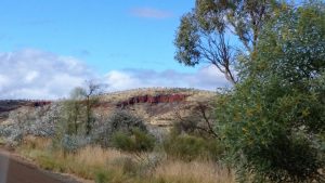
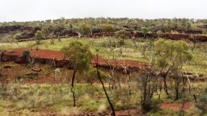
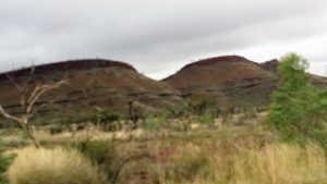
South of the range is a range of rocky hills which form a complete circle, said to where a very large meteorite impacted the earth many years ago.
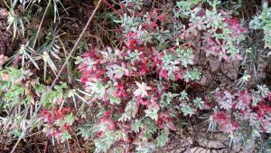
The Orche Pits are where the indigenous peoples gathered many colours. Serpentine gorge has a broad array of plants including some Cycads. Serpentine provided good picnic facilities. There is the walk to the waterhole and another up to the lookout. Avoided the lookout on this occasion, looked very steep. Ellery creek also has a gorge and has a larger waterhole than Serpentine.
Glen Helen Gorge
Image 1 of 9
The walk from the restaurant is short but strewn with obstacles mainly rocky river bed partially covered in reeds. But the tranquil view is rewarding.
Overnight in Alice Springs CP on north side of town after travelling from Ti Tree yesterday. Headed out to the West MacDonnell ranges yesterday. Set up camp in the campground at Ormiston Gorge, beautifully situated, good clean facilities, but tight spaces on sloping ground.
The road into Ormiston is sealed and provides a spectacular first look at the gorge as you round the last bends. Did some initial walking to check out a longer walk for today. The main waterhole is very peaceful and includes some bird life.
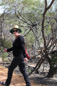
Ventured out early this morning on foot, alone, to trek the Ghost Gum Loop, the scenery is fantastic especially the colours in the morning light. The walk is steep in places and like a goat track following contours on very steep walls of the gorge followed by rough trek along the river bed strewn with large boulders as you make your way back to the main waterhole.
Left Mataranka yesterday and traveled south to Banka Banka with a short stop at Daly Waters. Stayed overnight at Banka Banka a caravan park with basic facilities about 100km north of Tennant Creek. Today we are camping at Ti Tree another caravan park with basic facilities behind the roadhouse and motel. All the campsites are crowded so it is good to pull in early, by 3pm to ensure a spot. Mornings are getting cold a sure sign we are heading south and inland. Covered about 800 km in 2 days, should be in Alice by tomorrow.
Visited Karlu Karlu today but only briefly, it has been much further developed for visitors than we I was here last about 20 years ago. Even has a national park style campground now. Some pictures of the rock formations below.
Banka Banka
Image 1 of 8
Taken from the lookout behind the caravan park looking to the east.
There are many sights to be seen and beautiful places to be seen and explored between Darwin and Katherine but not on this trip as I was keen to catchup with my travelling companions again at Mataranka. About 100km south of Katherine is Mataranka famous for its hot springs. But if you explore a little beyond the springs there is a very nice campground known as Jalmurark. Provides large shady sites, showers and flushing toilets. Spent 2 nights here, visited Bitter Springs, and the hot springs near the homestead. Both quite crowded, the hot springs bathing area was in the process of being renovated with what looked like a new lining, and paving being installed.
Had lunch today at Territory Manor nice surrounds but meal was a bit ordinary. Planning to push further south tomorrow.
Hiking to Mataranka Falls
Image 1 of 9
8km there and back from Jalmurark Campground to Korowan.
Finally left Kununurra about 23rd July, I have really enjoyed my stay in Kununarra and will try to return in the next couple of years. Stopped very briefly at Victoria River Roadhouse surrounded by beautiful, towering rock formations, would have liked to stay but maybe next time. Ended up spending the night in a very crowded, dull wayside stop known as Mathison Rest Area about 100km before Katherine. People just kept arriving even after dark. At least it made the run up to Darwin the next day a fairly easy drive.
Spent a week with my cousin and family in Darwin, very relaxing and restful time, with great company.
Got the car serviced as it was due, 8 week waiting list for dealer, so I used Repco where one of the family worked.
My cousin lives close to a water front so I was able to do my regular walking along the foreshore parkland, very enjoyable.
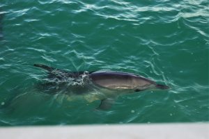
Leisurely Boat trip today up the Ord river, otherwise known as Lake Kununurra, to the Argyle Dam and back. At the start of our trip is the Ord Diversion Dam which keeps the stretch of river we are on at a relatively even height all year round. The trip is 55km in each direction. Lots of fresh water crocodiles but hard to see and photograph. As you get further upstream the rock canyons get more and more majestic and awesome. The bird life is prolific and we diverge up small creeks to observe many types of water birds and others.
The boat holds about 50 people but there is only about 12 of us on the way up meaning we could easily move about and gain the best perspective on all the fantastic vistas offered.
On the way back the boat was full as we picked up the group who only paid for one way having been bused to the dam wall. Very powerful engines I think over 500hp propelled us at high speed when required and crept along the creeks when required.
The late afternoon brought a whole new light to the outlook and a new colour spectrum to the rock formations. We were able to spot rock wallabies on the cliffs.
A very enjoyable day finished with sun setting over the river. Take a look at some of the photos I managed to take……………
Ok so this was the big day for flying. Up at 5am, cooked breakfast and off to the Kununurra Airport. All lined up for the aircraft, an Airvan manufactured in Gippsland, seats 8 including the pilot and has a high wing which is good for visibility on scenic flights. Turns out the pilot was only 23 but he did a great job. He carefully seated his passengers (presumably for weight distribution) and, to my surprise, put me in the co pilots seat so I was going to have great views. We headed north west and north of Wyndham taking in the enormous river delta made by the combining of 5 rivers, Pentacost, Ord, Durack, King and Forrest.
Ord Valley
Image 1 of 15
Ord Valley from the air just out of Kununurra Airfield
Then on round the coast inland to the Berkeley Riv and the Berkeley River Resort positioned on large sand dunes adjoining the beach (runs to $1600 a night min 3 nights I believe) but a spectacular wilderness location. Next highlight was the King George Falls and Gorge.
Coastline SE of Berkeley River
Image 1 of 21
Coastline SE of Berkeley River
On past Truscott Airfield which is still busy today, but was hidden from the Japanese in WW2, they bombed Kulumburu instead. Truscott is still used to service many gas and oil fields in the Timor Sea.
The Osborn Islands provide a very pretty view and are surrounded by pearl beds strung on large nets visible from the air.
Napier Broome Bay
Image 1 of 18
Napier Broome Bay
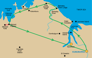
Landing on a dirt strip at Mitchell Plateau was uneventful. Lots of containers and fuel drums. One of the containers housed our next mode of transport, a modified Toyota Troop Carrier. Wes the pilot was kept very busy getting the truck out as well as serving us all morning tea. Then a very bumpy ride for 30 mins to the Mitchell Falls campground.
We were provided lunch to carry along with water and began our class 5 hike that is clamber over rocks and through the beautiful bush taking in Aboriginal rock art and various perspectives on the Merton Creek.
Rock Art 1
Image 1 of 12
Rock Art 1
.We first admired the Mitchell Falls from on top of the remarkable drop and then walked around to the other side of the gorge and a most spectacular view back toward the falls. The Mitchell River Falls are truly spectacular. On the way some of us had a dip in the river and lunch while admiring the Mitchell Falls.
As we stood by a relatively flat rock area adjacent to the river in came 2 helicopters to take us back to the campground with doors off so as to provide uninterrupted view of the entire vista.
Mitchell Falls - face on
Image 1 of 26
Mitchell Falls taken from lunch spot on opposite side of gorge.
We bounced our way back to the airfield and on the way came across a camper trailer, looked quite new, but the entire axle and suspension was all but completely torn adrift a reminder of how taxing these roads can be on vehicles.
The pilot worked hard preparing the aircraft and packing up, before we took to the air and followed a direct route back to Kununurra across this vast sparsly populated region, I only saw one road until we were back near Wyndham. But I did feel very satisfied with my day of flying and hiking.
Bush Hangar
Image 1 of 30
Our aircraft (Airvan manufactured in Australia by Gippsaero) being prepared for the trip home. The container next door provides storage for the aircrafts needs including fuel.
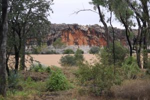
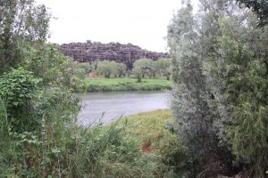
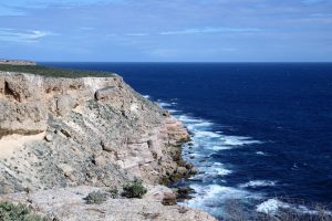
Local touring today. Along the Gibb River Rd (sealed for this portion) and out to El Questro station wilderness park. Large caravan park with up market motel accommodation and restaurant. I have been told the establishment is owned by an American company, Delaware North, and as such has moved well beyond a station stay. Negotiated rough road and a couple of river crossings to get there but tour buses also traverse this route. Then on to Wyndham and Port of Wyndham, yes they are separate, where we found the Rusty Shed restaurant/cafe for lunch. Up to the five rivers lookout very steep road up but rewarding views for up to 40 odd kms in all directions and the view does include five rivers – Ord, Forrest, King, Pentacost, and Durack.
Visit to the Grotto on the way back to Kununurra but none of us was game to tackle the rough steep steps which went down to the pool, apparently there are 300 steps but the start appears to walk you straight off a high rock cliff. If there had have been a bit more daylight available when we observed a young family with baby in sling and six or seven year old in tow emerge from this apparent cliff face, maybe I would have given it a go, or maybe I am just kidding myself.
Moved on to Kununurra yesterday, the vistas from the road where impressive and ever changing as we weaved our way through the scattered ranges. And of course the colours are impressive. Toward the end of the drive you come into the broad, green and flat valley of the Ord River, just across the river is the airfield on the edge of the township of Kununurra.
This morning was mainly a rest day, spent the morning at the local park based market, then domestic chores like washing and cleaning. Staying at Kimberlyland Caravan Park, nicely situated on the lake (actually the Ord river which is more like a lake near the town), nice clean facilities. Town has a reasonable size shopping centre, good range of services in the light industrial area, and unlike Broome is not overwhelmed by tourist facilities.
Toward the end of the day took a drive to the eastern edge of town and the Miriam National Park, contains a gorge that you drive into and then walk, or rather climb, up to the ramparts to look back over the town. Very picturesque.
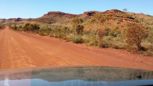
Left Fitzroy Crossing on the 13th. Investigated one possible wayside stop at Margaret River but looked crowded at 1pm, interesting bridge forms the entrance more like a broken down causeway. Spent little time in Halls Creek – looked like a fairly rough town lots of mesh. Passed the top end of the Tanami track – sign said it was closed due to recent rain. Finished the day at the privately run station stay style caravan park at the entrance to the Bungle Bungles (Purnululu National Park). Basic facilities, each bathroom building houses two bathrooms, corrugated iron walls, no lining and no roof, each bathroom has solar powered light, toilet and shower with no dividers, if your lucky the gas cylinder provided for each buildings hot water is still charged.
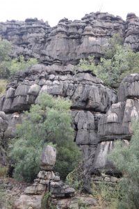
Fantastic day walking the southern end of the Bungle Bungles. The colours are glorious and you feel like taking a photo at every turn. Rough track in about 75km of twisty road with some loose rock and some moderate corrugations. No access for caravans although offroad van would readily manage the road, so we parked at the caravan park at the entrance.
The walks included I competed included Cathedral Gorge, The Window, and the Picanny Lookout. Cathedral Gorge had a very peaceful atmosphere and spent some time soaking it in.
Approaching Bungle Bungles
Image 1 of 48
Approach to the Bungle Bungles keeps it secrets until you are on top of it.
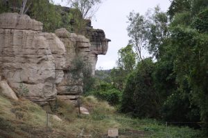
Just outside Fitzroy Crossing to the north west is the ‘sister’ gorge to Windjana, known as Geikie Gorge. Geikie is quite different and not as majestic as Windjana. Here the river is much deeper and wider, the rock formations are more easily approached, not as high or as difficult to clamber. If the crocs are as prevalent they are not as obvious.
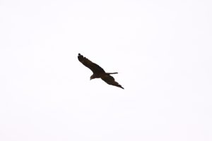
What some things will do to live.Like perfectly formed building blocks the rocks are stacked up.Some amazing shapes are taken on as the rocks erode.The contrasting colours look fantastic.This rock appeared unique it was almost crystal like in its shape and form.The river is wide and deep here. In fact a cruise is available, cancelled the day we visited due to very cautious parks officers concern about the threat of rain.Kytes are very numerous throughout the Kimberley.
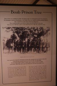
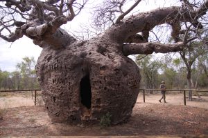
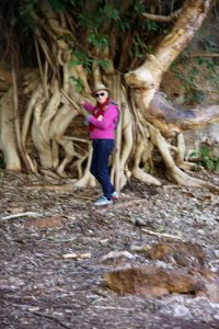
On the 11th July we paid a quick visit to the Boab prison tree, there seem to be a number of these across the Kimberley. They were used to support the cruel practice of holding captured forced labour from the indigenous people.
One common characteristic of even the well used sealed roads in this area is the one lane bridges, given the flood characteristics these can be quite long. A local practice seems to be left hand indicator means I am going to stop and allow you to cross and right hand indicator means I am coming through please make way for me. In any case these deserve some care as they are numerous.
Fitzroy Crossing was a bit of a surprise in that although quite small it has a resort that incorporates a caravan park. We opted for an unpowered site and were offered anywhere on a grassed, mown and sparesly treed 5 hectares, beautiful.
Funny what happens when the ablutions exhaust the supply of toilet paper in the gents. I could hear multiple conversations on mobile phones from the cubicle occupants calling the resort management and they were aggressive. Consider your own supply when using shared facilities.
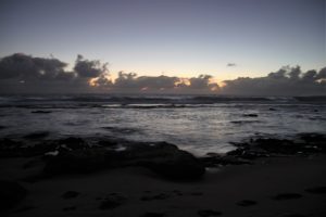
Travelled from Broome to Derby on the 9th and caught another beautiful sunset from the Derby Wharf. There is a very nice coffee shop at the Wharf.
Rose early on the 10th and walked to the Wharf and back, had many others doing the same, even though it is across a flat clay pan.
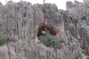
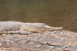
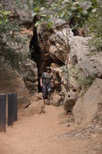
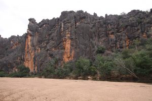
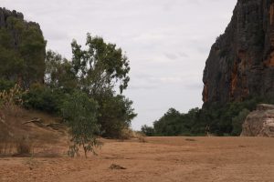
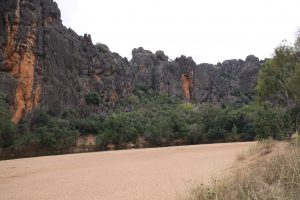
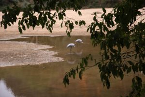
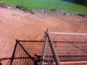
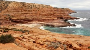
Ventured down the Gibb River Rd to visit Windjana Gorge, a magical place with lots of wildlife including many fresh water crocodiles. This section of the Gibb was almost all in the process of being sealed or already sealed, but the track into the gorge was badly corrugated.
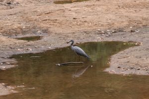
The track to Windjana continues on to Fitzroy Crossing but we went back to Derby. Windjana Gorge has a magical entrance being a slit in the rock big enough for people to walk comfortably through, it opens out onto a river bank overlooking much bird life and lots of freshwater crocs. Further up the Gorge it widens out and has a large sandy beach surrounded by ramparts of rock wall in colours that welcome the sun.
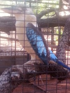
KingfisherInteresting cave high up in the rock wall is home to some fern like plantsThese birds seemed to get on ok with the crocs.This fellow tolerated people taking selfies over their shoulder within 3 metres.The slit like entrance to the Gorge
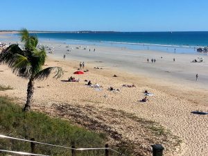
First full day in Broome, very much a tourist town. Coffee at the Dragonfly cafe. Followed by a visit to the museum surprising how much involvement Broome had in the second world war especially dutch evacuation of Java. Lunch at the green mango bit slow but very nice food. Many of the restaurants are in what is known as Chinatown it is situated right underneath the final few hundred metres of the approach to the main airport runway. That is the airport is in the centre of town.
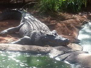
Then a visit to Malcolm Douglas wildlife park. Lots of crocs seemed like a well run zoo, interesting flying foxes – like large bats. The park seems to house all the trouble making crocs from across the Kimberley. Quick visit to Town Beach Thursday market.
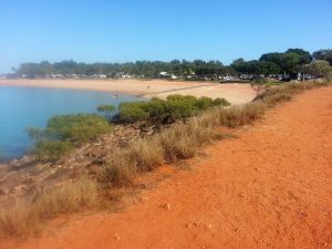
We stayed at a caravan park in Port Drive, very very small sites, hence facilities over crowded, real estate must be at a premium in Broome.
Spent an hour at Cable Beach surrounded by resorts and included its own area for 4WD’s to use. You may have gathered by now I am not a big fan of Broome, suits the Latte set who fly in and out though.
Ate at Matso’s one night – very nice meal and service.
Not very friendlyThe zoo did not just have crocs although they were a key focus.The infamous Cable Beach – very pretty and surrounded by resorts.More take as it is – Town Beach – surrounded by a caravan park.Feeding time at the zoo.
Today was a travel day north through Port Hedland yet again on past the road to Eighty Mile beach, would have liked to had a look at this beach but you cannot do everything. Had lunch at Pardoo and stayed the night at Sandfire Roadhouse. Nice for a roadhouse, you share the park with a number of domestic animals. peacocks, ducks, chooks, even camels.
Not my photo but a good example of the wayside stop drop toilet.
Up bright and early Monday morning, nice breakfast at the Esplanade hotel in Port Hedland, and off to the airport. Sad to be parted but Chris is keen to maintain her Business, so I will continue without her company.
Then drove 250Km back to Karratha to retrieve the caravan and tow it 200km north to a wayside stop on the Peawah River. Unfortunately departure from Karratha is delayed but yet another water in fuel warning light. This time I sought some guidance from the mechanic and how to drain the filter so I can self service in future.
Wayside stops are interesting – there are way to few in WA, they tend to be alongside dry riverbeds and provide a large parking area off the road but near enough to hear all the road noise. They typically have one or two drop toilets (if you dont know what that is do some research). These days they are perched on top of a collection tank so you have to climb up stairs or ramp onto a raised platform to enter them. They are often very smelly.
Around 2pm the travellers start to collect, parking their vans in the shade where possible and they just keep coming until either the spot is bursting with vans or 7pm rolls around. In this case there would have been about 30+ vehicles by 7pm.
There is an interesting etiquette on the parking dance. How close do you get to those already there, many seem to want to get very close for security perhaps, others cannot be too far away. But by the end of the evening you are all crammed in anyway.
Personally I am not a fan of these overnight stops I would much prefer a National Park but some times they are difficult to avoid.
Unfortunately we got the timing a bit wrong for this next move.
We had booked Chris to fly home on Monday, tomorrow, but from Port Hedland. And we were still in Karratha. We tried to book a caravan site in Port Hedland without success. So instead we booked a hotel room for Sunday night, left the van in Karratha Caravan Park and drove to Port Hedland on the Sunday, about 200Km. Had a lovely dinner and evening at the hotel.
Port Hedland is not very attractive more like an industrial wasteland. Some photos –
Unfortunately this was the view from the hotel balcony.
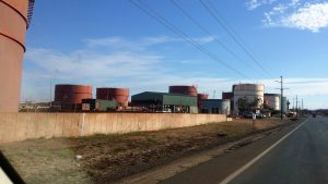
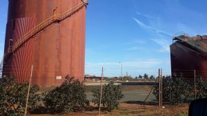
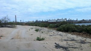
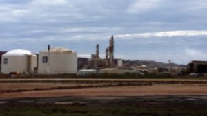
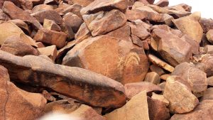
Karratha at its core is a mining town. The north west shelf gas processing plant is adjacent to the town across some salt lakes. In the same area are what looks like large piles of rocks but these are in their natural form and reportedly full of indigenous art. The town has many service industries and a couple of large areas dedicated to light industrial.
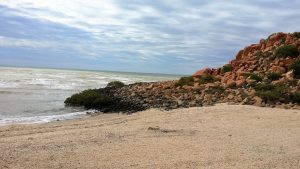
Below are some photos of the indigenous art and the gas processing plant. The plant is on the Burrup Peninsula out past Dampier. On the same peninsula is Hearsons Cove a piece of beauty amongst the industry.
One end of the beach at Pearsons Cove – note the natural rock pilesThe gas plant viewed from a nearby beach.Some examples of the indigenous rock art.
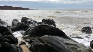
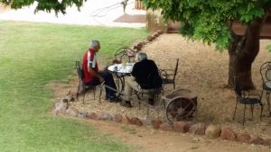
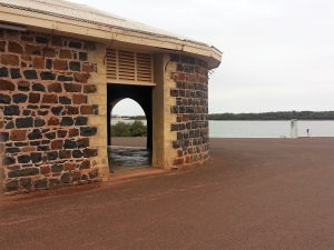
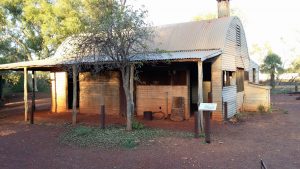
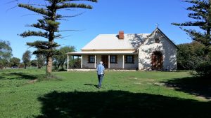
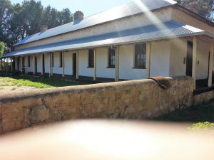
Cossack is about 50km north of Karratha, it is now managed as an historic site as it was once the main port for the region until the ships got too big. European settlement history for this area began more than 150 years ago.
There are a handful of buildings with museum displays in many.
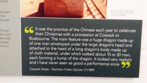
Enjoying a morning coffee in the gardens at CossackAs with many places in Australia the Chinese played an active part in history.A view of the warehouse at the old port.The historic CourthouseAn overview of the historic town – not very large.
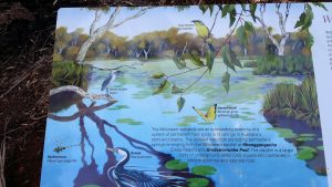
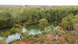
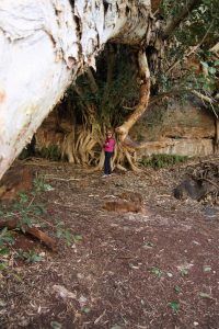
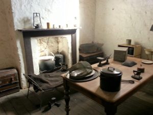
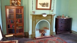
This is one of the best places we have stayed. Close by is the original homestead now used as a bit of a museum. Adjacent to this is a lovely bet of wetland with a creek and walking paths running through it.
On the first morning I hiked about 6km across open savannah to a rise that overlooks the water course and lush wetlands and then returned via the wetland with its vast array of birdlife active in the early morning.
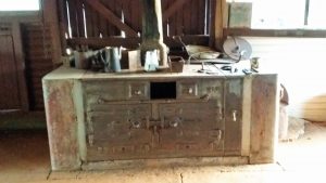
This seemed easier than trying to take bird photosWhat a stove – attached to the homestead.Chris relaxingAn example of the locos used to pull the ore trains down to Karratha. typical ore train is 30,000 tonsAdmiring the river at Millstream
We stayed 2 nights and then headed out to Karratha.
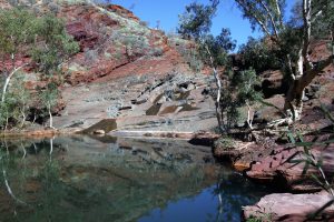
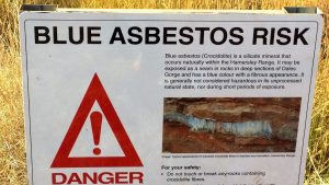
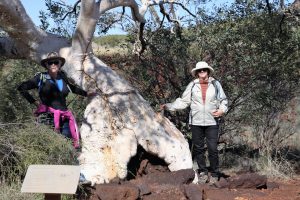
Today we left Dales Gorge and proceeded back to Tom Price for more water in fuel treatment and then on to Hammersly Gorge a very pretty spot.
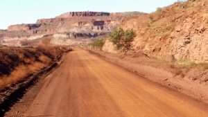
After admiring this gorge we went is search of Florance Station listed as offering accommodation. Immediately beyond the gorge the road makes its way through its own beautiful but tight gorge and then out on to open savannah country. The road still had many mud patches left over from the rain. Our efforts were in vain as Florance is closed to visitors these days. After consulting the maps and Camps book we headed for Millstream National Park. This involved using the shared mine railway maintenance road. On this road we encountered many mine vehicles one was going very fast in the opposite direction and sprayed us with rocks resulting in 2 large cracks in the windscreen, these will probably remain until we get home. Arrived at Millstream about 5pm and managed to secure 2 camp sites probably made easier by the somewhat inclement weather.
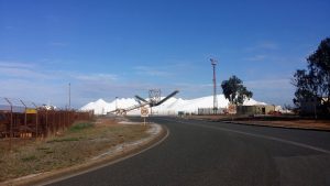
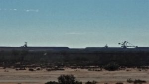
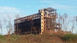
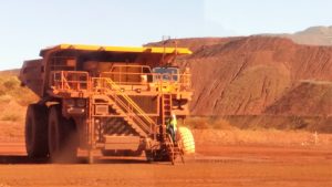
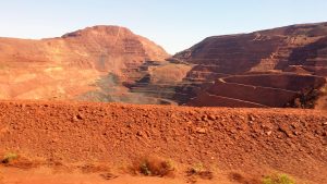
Today we headed back to Tom Price for a tour of the mine. On the way both our vehicles encountered water in the fuel warnings. So we both fronted up to the local mechanic who said this was a very common occurance in the area.
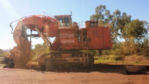
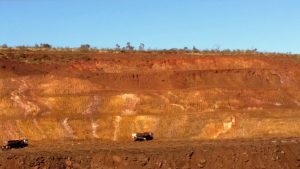
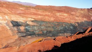
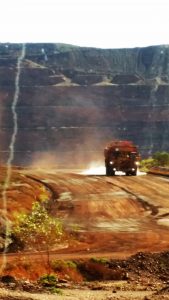
The tour of the Tom Price provided an impressive view of this large undertaking. There appears to be an entire mountain missing and a large hole underneath where it should have been. One observation of note – the focus on safety in the mine is unrelenting and all encompassing. See below……
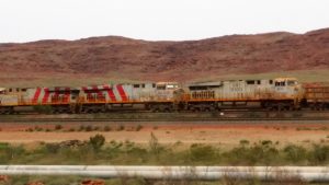
When the driver needs a staircase the truck is big.There used to be a mountain here.well maintained mine roads are like freeways.One of the original digging machines now retired.This is a site being prepared with explosives for blasting – you can just make out the lines of drill holes holding the explosiveThe dark area is an enormous hole in high grade ore.The processing plant – this ultimately loads the trains each weighing in at 30000 tons
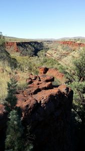
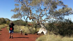
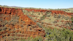
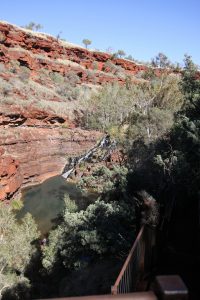
We arrived at the Karijini National Park, specifically the Dales Gorge campground quite late but still managed to secure two adjoining sites. These were typical NP sites with drop toilets, big sites, spread apart, and well maintained.
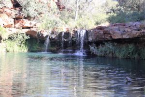
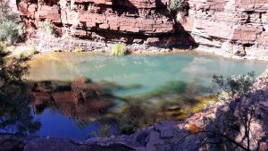
Today, Sunday, we hiked along the top of Dales Gorge after exploring the rock pools in the top end of the gorge. It really is a serene place of rough beauty.
Superb pool which feeds water into the gorge. Great swimming spot.This applies to the whole region.Chris admiring the structure of this tree.Long way down – there is a set of stairs to help out.I really like to colours of this land.The vast schism that is this gorge.Hmm do I dress for hot or cold, certainly not for fashion.
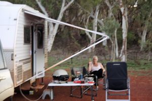
Friday morning we set off from Exmouth to reach Cheela station for the night. Fortunately Chris drove as my mobility is limited today, it was a long day for her with rain setting in toward the end. The landscape was a little varied but very flat most of the day as can be seen in the photos. When we reached Cheela it was very muddy and looked more like a mining support facility. Managed to find some coarse gravel to park the vans on and at least the showers were clean and hot.
Note the long row of mining trucks at Cheela.There you go not all flat.Think the rainfall might be low here. Exmouth Nanutarra road.On the way to Tom PriceNear Tom PriceBoth the weather and the ranges are closing in near Karijini,Evidence of the over night rain.
This was typical closer to Exmouth than the other shots on this page.
Saturday morning we decided to push on and refueled in Parabadoo, almost immediately my companions had a dash light warning of water in the diesel. We managed to get to Tom Price where we found a mechanic to drain the system.
From Tom Price we set off for Karijini National Park and the Dales Gorge National Park.
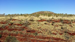
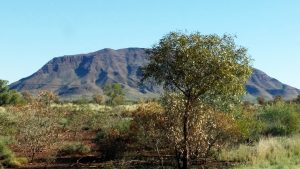
The landscape is more varied and full of prominent rocky ranges as can be seen below.
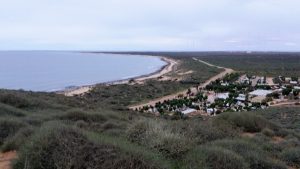
Time to leave the wilderness of the station via the dry weather route and move on to another equally beautiful wilderness in Cape Range National Park. The park offered fairly large sites nicely situated and in small groups so as to retain some sense of the place. Unfortunately we could only secure one night in the National Park and spent the following couple of days in the Lighthouse caravan park, fairly average accommodation. By now we had got used to poor quality water supplies and all our drinking water came from bottled sources, this approach extends the effective tank size of the van from 180L to whatever you want but a little over 200L was common for us.
Exmouth is set up for both support of the Defence Forces and Tourism. Good water is available at the visitors centre. We ate out at one of half a dozen local restaurants, Kennedy St, had to mark them down on their steaks but otherwise it was good. Excellent caravan spares business helped us out with a number of, normally, hard to get items.
The sign at the homestead indicating the main road out was closed.The beach at Cape RangeThe flora in the National Park was more varied than found on the stations.More beach at Cape Range adjacent to camp groundLooking down on the caravan park from lighthouse hill. Out to sea you make out gas and oil rigs at night.You can just see the defence radio installation in this picture, must be very long wavelength.
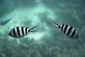
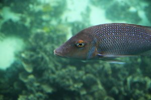
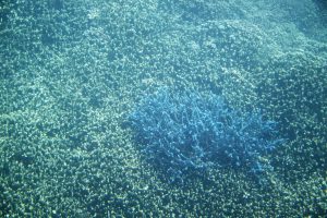
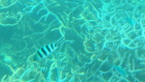
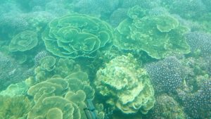
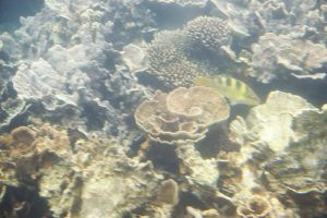
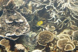
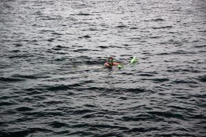
Today we have booked a glass bottom boat tour off Coral Bay. This includes snorkeling activities for those willing to get wet.
There were many beautiful fish and coral to see, the photos through the glass do not do them justice. And some strange looking, easily excited, creatures with noodles and web feet.
Great excitement over how close the fish are, fortunately no sharks seen.
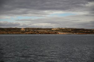
We headed out of Carnarvon today up toward Coral Bay, turning off the bitumen to stay at Warroora Station. This is a real bit of wilderness, camps situated at least 500m apart with open plains on one side and a dune come cliff separating us from the ocean on the other side.
Rain is forecast and apparently the road in becomes impassable with only a little rain, fortunately there are alternatives, albeit a bit rough and slow.
The moon gave off a magical light in this vastness.As the rain rolls in behind me we look so tiny in this place.
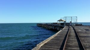
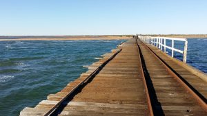
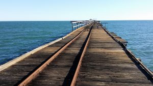
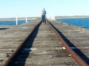
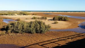
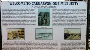
Carnarvon has a very long Jetty which is now only used as a suitable fishing platform. I measured it at about 1.5 km. It crosses a significant length of sand and mangroves before crossing the ocean.
Drove out about 100km to visit the Rocky Pool – this was a bit disappointing and difficult to explore on foot due to the rock formations surrounding it.
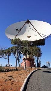
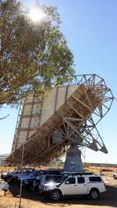
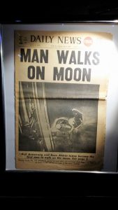
This is a well maintained facility, it provides educational insight into the key role that Carnarvon has played in the exploration of space. We spent a few hours here.
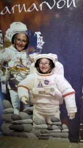
Old Telex machine – quite important in my own career – I interfaced these to computers – translating the baudot code to ascii.This dish is no longer operational but is quite large next to the modern NBN dishes.What a strange antennaSome people just have to clown around.
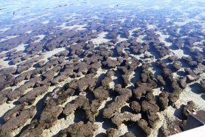
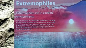
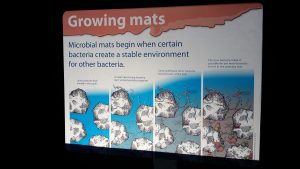
We set off to Carnarvon, on the way we are keen to satisfy our curiosity about Stromolites at Hamelin Pool. Having been there I am not sure I any the wiser. See what you make of it –
Lunch at a place called Wooramel Roadhouse, quite isolated. Catered for all our dietary restrictions, great food.
Arrived at Capricorn caravan park, where they will actually park your van for you, and found NBN dishes in the back yard all lit up at night.
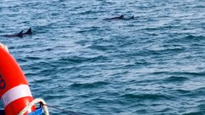
We spent today on a catamaran observing dolphins, turtles and birds of the sea. Departed from Monkey Mia. Explored Denham the previous day – very much a tourist town but still little development in this region which is good if you want the raw image.
Finished the day with another sunset session on the way back to Nanga Bay.
the weary cameraman toils on.Nature quells the heat of the day.Nature expresses tranquility so beautifullyChris cannot believe the beauty of this vast place.Most effective fisherman.
Today we pushed on to the Shark Bay region. Had planned to stay at Hamelin Homestead, changed plan and ended up at Nanga Bay caravan park, not our best decision. Serviced by very mineralised bore water and old facilities. Nice location on the beach though. This will be our base for Monkey Mia and Denham. Some shots of the sunset –
Have been suffering mild toothache all weekend. Dreading this will turn to major pain as we head north and away from reasonable services. No dentists in Kalbarri, managed to book one in Geraldton. So we drive back to Geraldton for the day and see the dentist. He assures me there is no major decay in the tooth although it is getting thin. On his recommendation he takes a little height of the tooth and allows it some relief in the bite. He is kind enough to provide antibiotics in case things turn nasty down the track. So we drive back to Kalbarri feeling like we can manage the situation. Tooth (or my mind) is feeling better already.
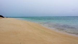
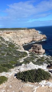
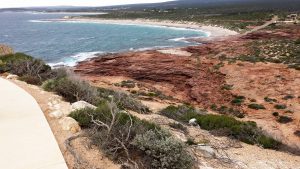
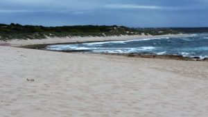
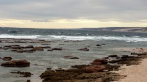
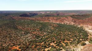
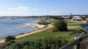
The is a large well protected beach at Kalbarri adjacent to a river mouth and protected by the reef which is close to shore and runs almost continuously along this coast. To the south are cliffs which hide secluded small beaches.
Bravely peeking over the edge.The colours of the sea are impressive.
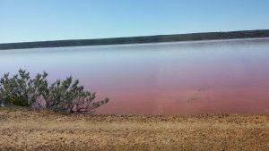
The Jayco on the left is my companion and the Evernew is my temporary home. Here we are parked at Gregory for lunch.Fisherman at work near Gregory, inside the reef you can see in the background.This large pink body of water is known as Hutt Lagoon, colour is due to salt and algae interaction. The algae is harvested commercially.
Moved on to Kalbarri. Kalbarri is a town largely just for tourists, it has multiple resorts, beautiful beaches and multiple caravan parks. We chose Tudor Lodge, no complaints nice park.
On the way to Kalbarri we called in briefly at Gregory and past the pink lake.
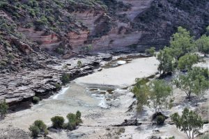
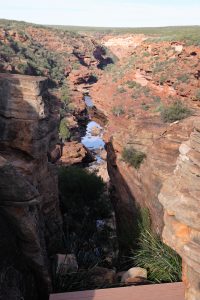
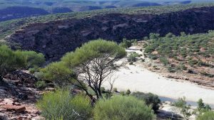
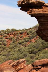
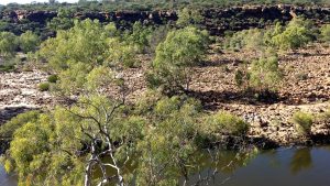
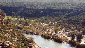
Kalbarri is in a National Park of the same name, and contains a number of impressive gorges on the Murchison River.
Chris proceeding with purpose.This must be an awesome sight when the Murchison is in flood.
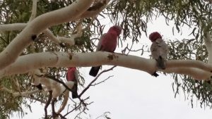
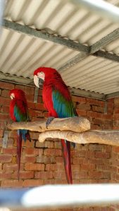
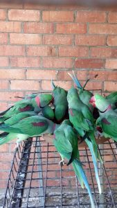
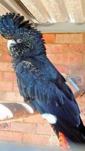
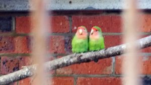
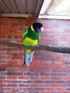
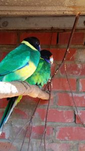
Kalbarri has, as a tourist attraction, a large collection of caged birds.
I guess I should have noted the type of each bird, but I didn’t so you can.
Jurien Bay – on the way to Geraldton.Church at Greenough, appears to still be regularly used.An original homestead later used to house Nuns.Interior of the Police StationBy far the largest building, Police Station, Residence and Cell Block.
Arrived in Geraldton afternoon of the 8th June. Caravan Park (Belair) seems to be in the industrial end of town.
Spent the next day exploring the historical site of Greenough, some shots below. This settlement proved to be flood prone and was not further developed. Geraldton is an important port for both mining and agriculture today.
The first night we found out what was on the other side of the 3 meter high brick fence beside our van site – it was a shunting line for unloading ore trains all night long – very annoying.
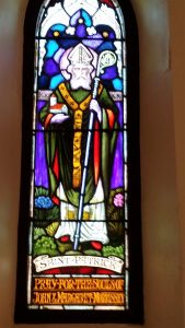
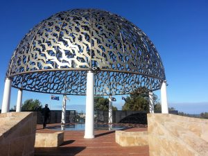
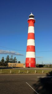
Geraldton Port with Town Centre in foregroundHMAS Sydney Memorial Geraldton – situated on hill in the middle of town.Geraldton Lighthouse – no longer in use. First all metal lighthouse in Oz.Victoria Hospital Geraldton – historic no longer used as a hospital
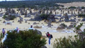
From Northam we spent a morning in Toodyay. Very picturesque, historic town. Then we headed on north to Regans Ford. It was cold and wet and the only caravan park was quite run down and it appeared we were the only occupants. Not recommended.
But this was a good place to leave from to see the Pinnacles Desert, a very eerie landscape.
Picked up Chris from Perth airport today. Chris had not been to Perth so we did a little tour of the city and had lunch at the Freemantle restaurants. Then we drove out toward Northam and saw some of the Avon National Park on the way.
Been staying with my cousin Kenny and Carol, wonderful hosts, with many interesting stories about building water pipelines all over WA.
Picked up my Yoga 900 while in Perth. Hope to have it running Mint real soon.
Leaving Northam tomorrow to catch up with my other travelling companions Willy and Michael.
What a shock it was, driving along the Great Eastern Hwy just west of Meredin towing my caravan the road widened into two lanes in my direction and a noisy Harley roars past. Next thing there is an explosion in my right ear and I am struggling to understand what just happened, I can no longer see out of the drivers window, I guess the bike flicked a stone up and my drivers window is shattered and slowly disintegrating all over me.
I pull over and assess what I can do, I need one of those old fashioned plastic emergency plastic windows. At the next roadhouse all I can find is a roll of Glad Wrap, winding this around the door frame and what is left of the window seems to allow me to proceed at a reasonable speed and so on to Northam we go. $500 and a day later we have a new window.
Set off early from Cooma. Conflicting advice on the Alpine Way. Finally a notice said trailers are banned so turned off to Adaminiby. Beautiful valleys green as green, real blue hills country.Up to Cabramatta, highest town in Australia shrouded in mist, snow lying about. Down into the clear great mountainous country. Tumut power stations rather ugly Tumut river valley very pretty. Drove into Albury to have lunch about 2:00. I drove to Benalla. Leigh had check flight in spite of rain. Then home, beaut sunset. Kerard here by chance to greet us. Dougall very excited.
Left early rang Cathy for Wendy’s address. Had another look at buildings in Windsor on to Richmond where we went for a walk to see a variety of early houses and buildings. John Bowmans house in the style of Elizabeth Farm, would like a house like that one day. On to Cambden saw another museum early photos back to 1805. Belgennie Farm which was MacAthurs first farm and Cambden Park. Good collection of early tools etc. Had a look at a group of buildings, the church and then drove towards Canberra but missed seeing Cambden Park. Drove down freeway rolling hills real sheep country. Drove into Canberra straight towards parliament house, magnificent sight , front on quite imaginative side view a little square and dull but really different. Out by Mugga Way and up a beautiful valley towards Cooma. Some very lovely views and quite old buildings. Staying at Cooma Motor Inn tonight. We are getting more expensive each night.
Left at 7:00 but went looking for North’s and didn’t leave Woy Woy till 8:45. We found their house after many turns and hills. Ideal position with cruider moored at the back door. Lovely bay and view. Then more hills and curves to get on to the highway through very rugged bushland Brisbane Waters National Park. Found the highway crossed over and set off to Wiseman’s Ferry across the Hawkesbury. Very steep, lots of cultivation, very pretty wound up to Central Mangrove then back down river. It was dirty, dark and mangroves along the edge not as nice as yesterday’s rivers. Across the ferry and up a very steep climb tjo look out over the valley. Through similar country to Windsor. Very historic town Museum Molly well done based on interesting and famous residents John Tebbutt astronomer, John Grono, boat builder pioneer farming families etc. Thompson Square with original buildings, St Matthews Church architect Francis Greenway. Stone laid by Governor Macquarie unaltered since then, makes history right with you. Lunched at Loder’s House. We didn’t have breakfast and by 12:00 I was feeling rather poorly but felt better after lunch so perhaps was hungry. Beautiful warm day. Also saw the Count House (Francis Greenway) a row of cottages and John Tebbutt house and observatory which is soon tjo be open to the public. Booked in at Riverview Caravan Park in Wilberforce, took on on site van in case of cold but it is a mild night really, still it is good to have a few comforts. Rang Viv.
Set off for Wauchope to Timber town. Dropped off the tyre to be fixed. Timbertown was very good. Steam Train ride, bullocks yoked and working. Timber mill, different levels of housing in Timbertown – log hut almost like Lynwood. Bakers, pub, wood turning stayed till lunchtime. Called in to see the Big Bull then set off. Taree, Newcastle, Gosford, lovely farm country, mountain parks, and then coal mines at Newcastle. Got to Gosford in the dark. Drove around to get into a caravan park one wouldn’t answer finally got in but not impressed.
Bush breakfast cancelled. So we ate inside packed our truck nd set off. When Leigh had recovered from the charge quoted being per person, glad twe got our cut lunch. Lovely trip down the mountains and the Numinbah Valley. Across the border through banana farms to Murwillimbah, Byron Bay to Ballina. On to Grafton and Coff’s Harbour. Had lunch at Chatswood Island. Lovely spot under Jackaranda’s and looking across the river. I had a couple of spells of driving. The second I felt the car pulling to the right didn’t realise we had a flat tyre until it was really flat at Macksville. Continued to Kempsy and Port McQuarie, turned into a caravan park off the road not sure where we are but nice park. River Lodge Port MacQuarie.
Said goodbye to Morris and co. Went into Caboulture for bank etc. Set off round Brisbane via Gold Coast Gateway down through Southport, Surfers Paradise etc. Very crowded and cluttered. Went to Sea World but too costly for our purposes. Called in at Tiger Moth joy flights but none going. Had lunch at Nerang and out to Binna Burra. Good scenic trip. Very tasteful cabins layout etc. Good Food, star talk.
Went together by taxi. Saw Britain Italy and several others. Listened to American Singers. Went to Victoria and we went with Morris to see the Magna Carta and Queensland very good. Saw the diamonds in WA. Very very tired.


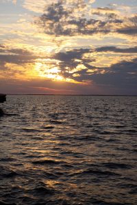
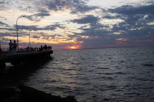 Travelled from Broome to Derby on the 9th and caught another beautiful sunset from the Derby Wharf. There is a very nice coffee shop at the Wharf.
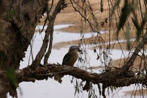


 Today we have booked a glass bottom boat tour off Coral Bay. This includes snorkeling activities for those willing to get wet.
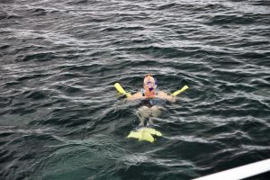


 ne and was not further developed. Geraldton is an important port for both mining and agriculture today.
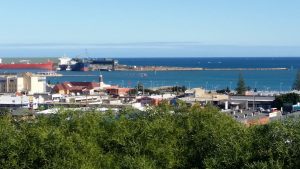

 very eerie landscape.